🗺️ Nature in the HoB (2020) | WWF-Malaysia
A series of maps were created for the book published by WWF-Malaysia and FORMADAT (Forum Masyarakat Adat Dataran Tinggi Borneo).
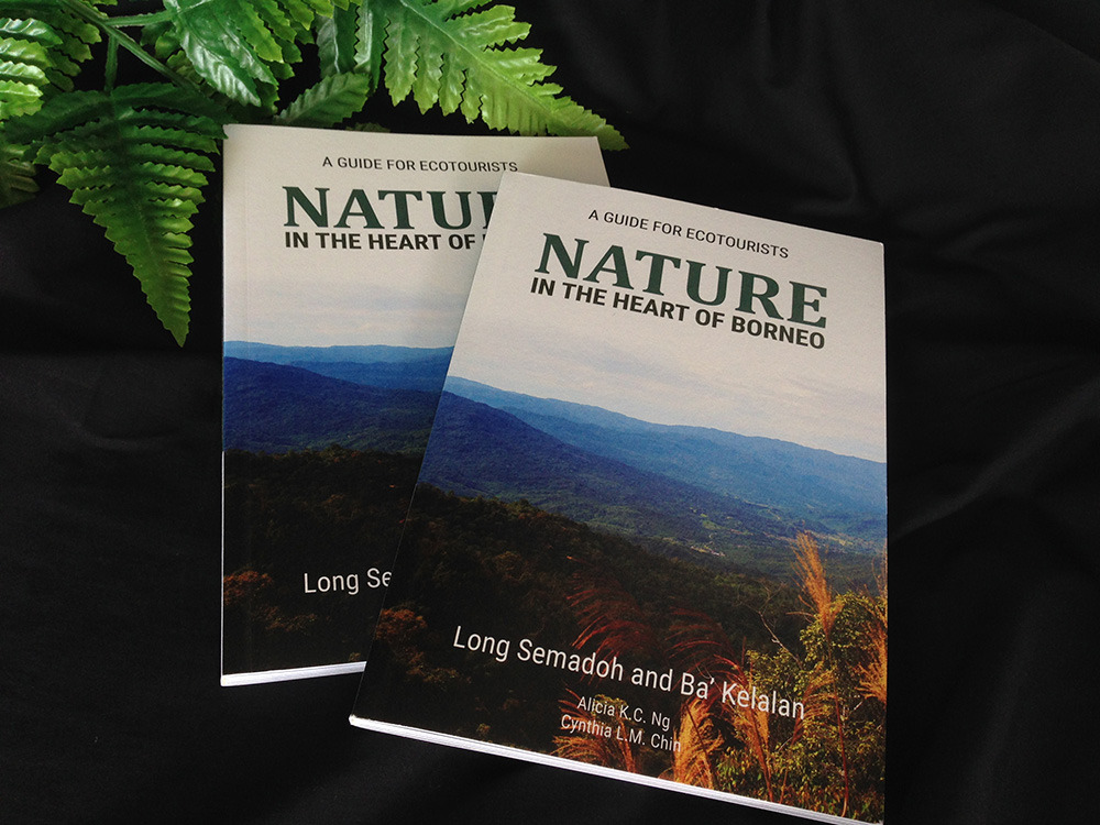
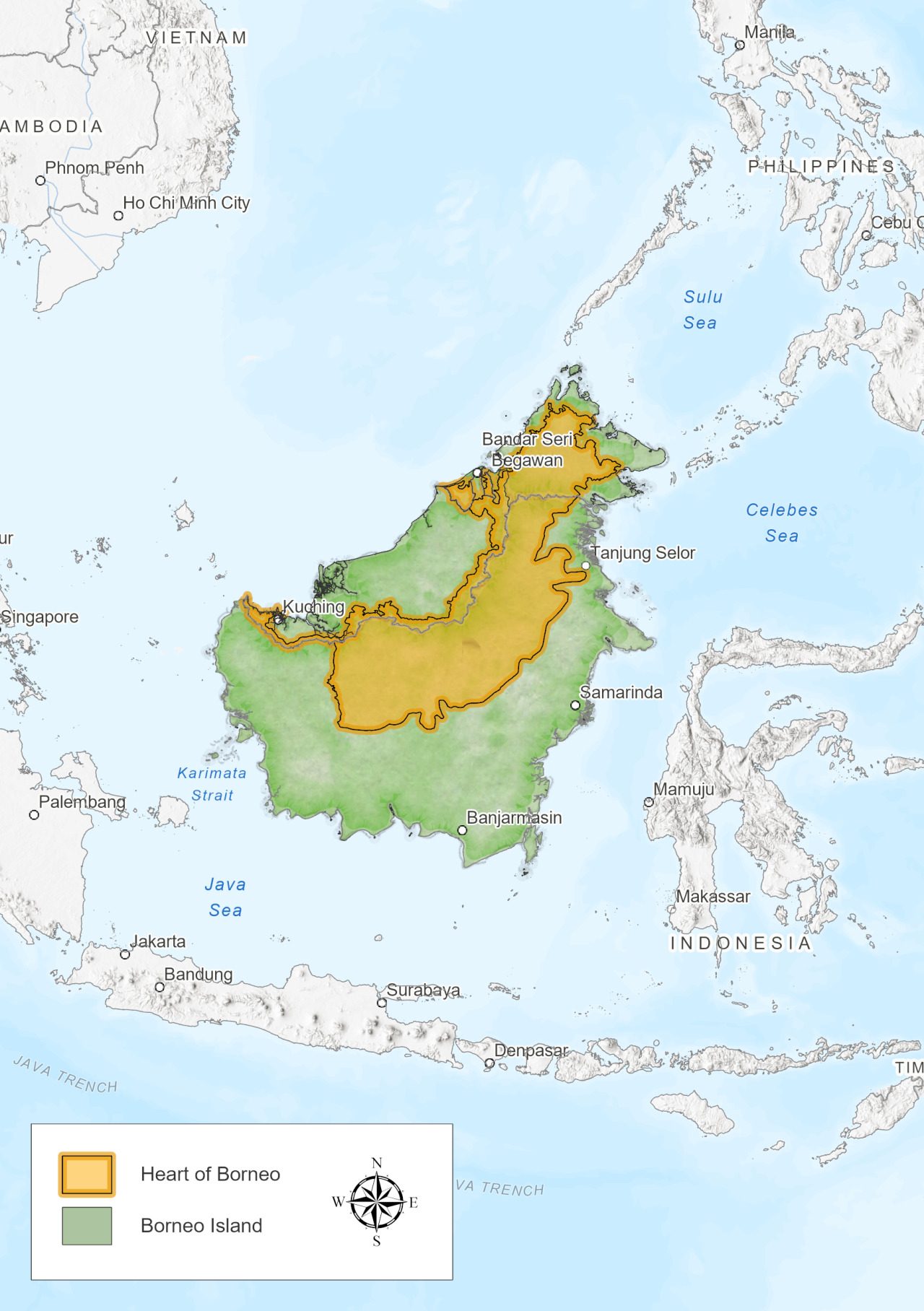
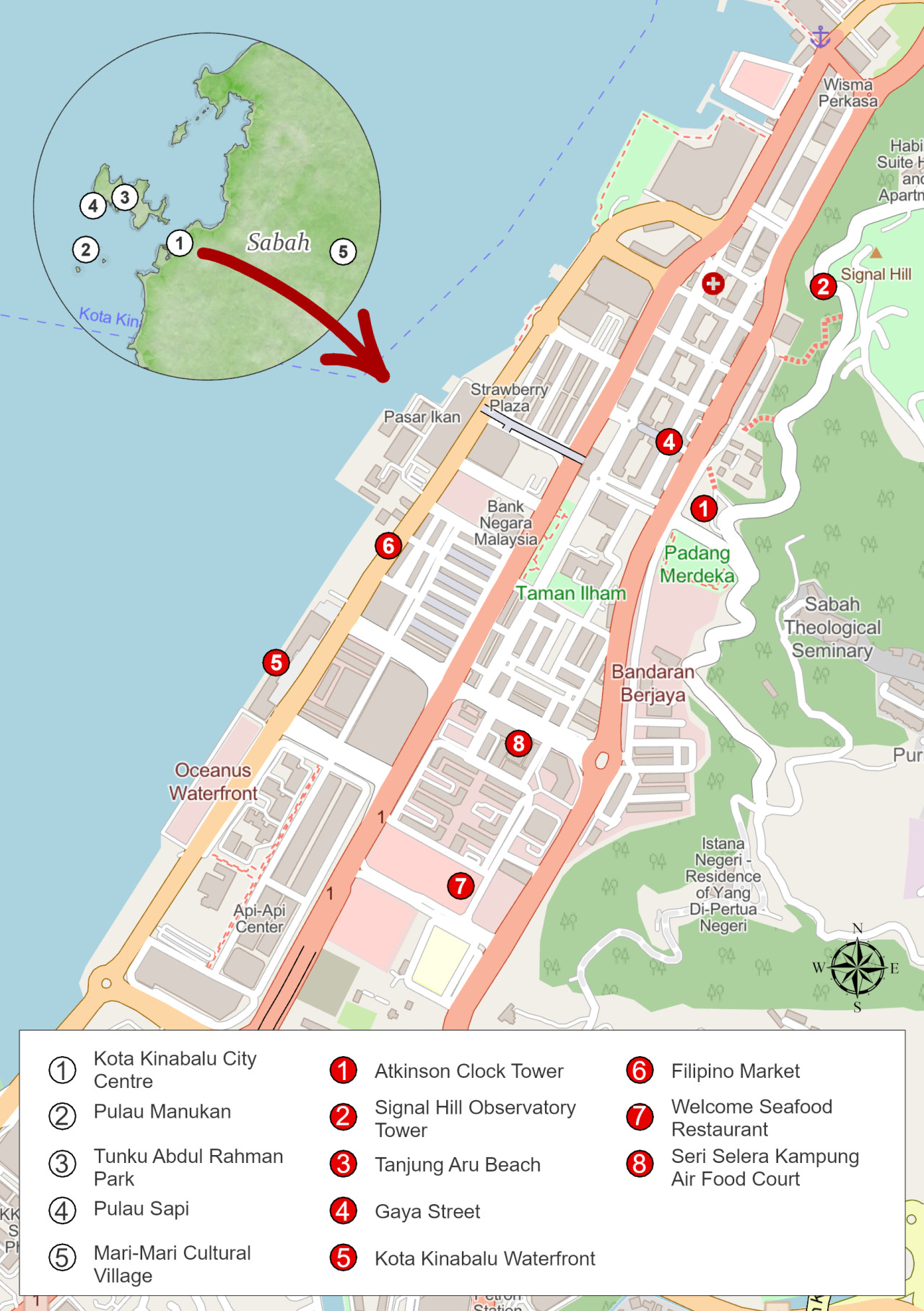
This book was meant as a guide to some of the natural attractions at Northern parts of Sarawak which includes the black gold region of the Sarawak state; Miri, and the pearl of the Borneo island, Sabah. Notable locations of nature’s peculiar feats are shared for those who seek to explore the northern states for the first time.
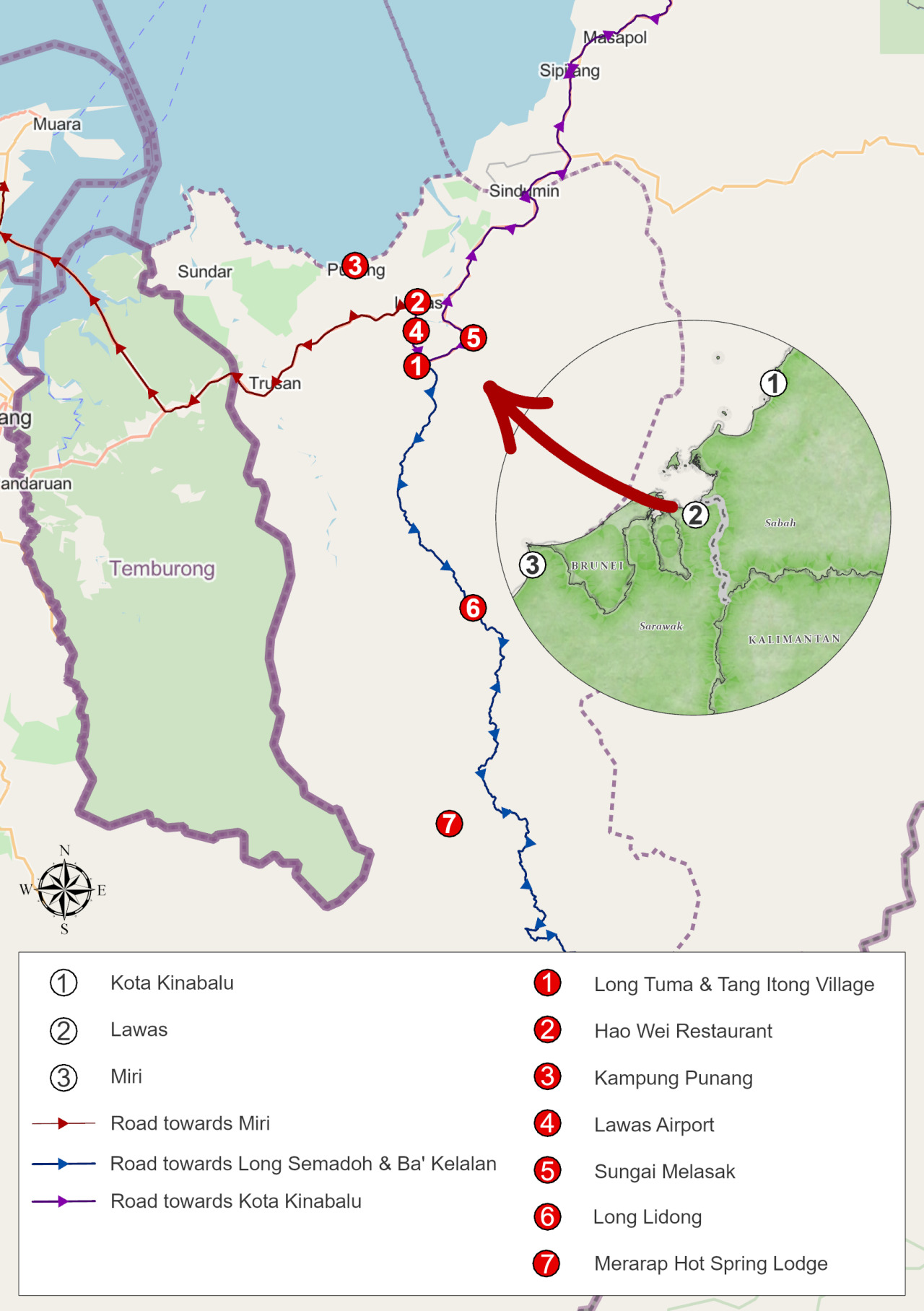
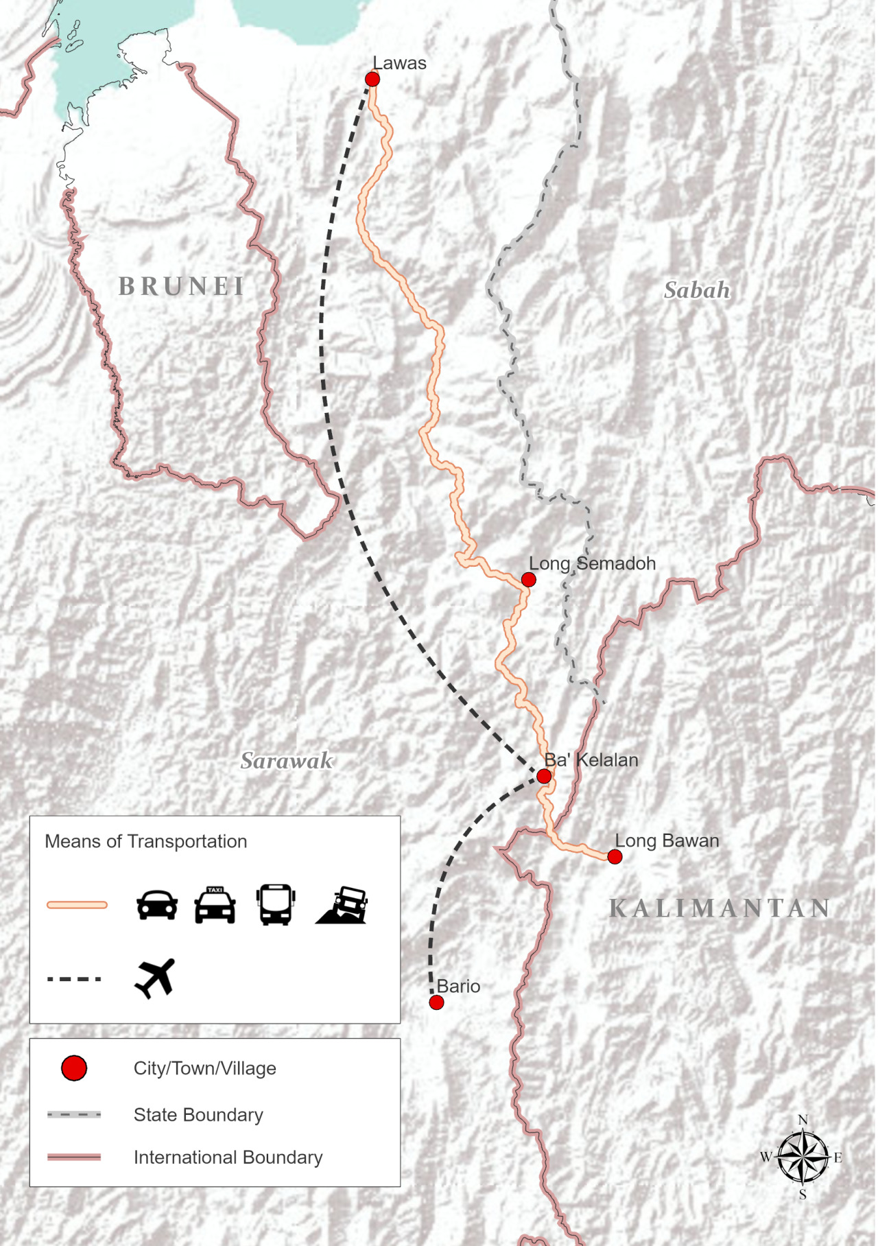
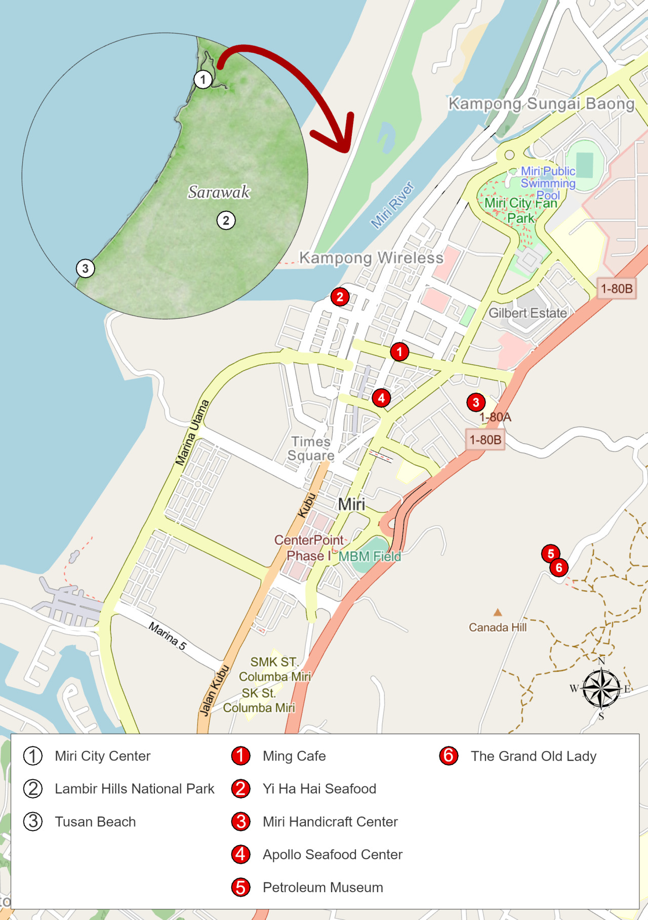
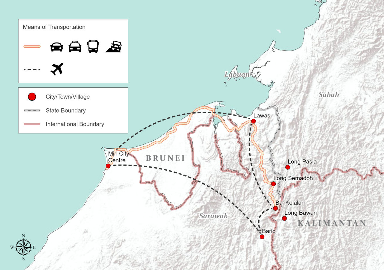
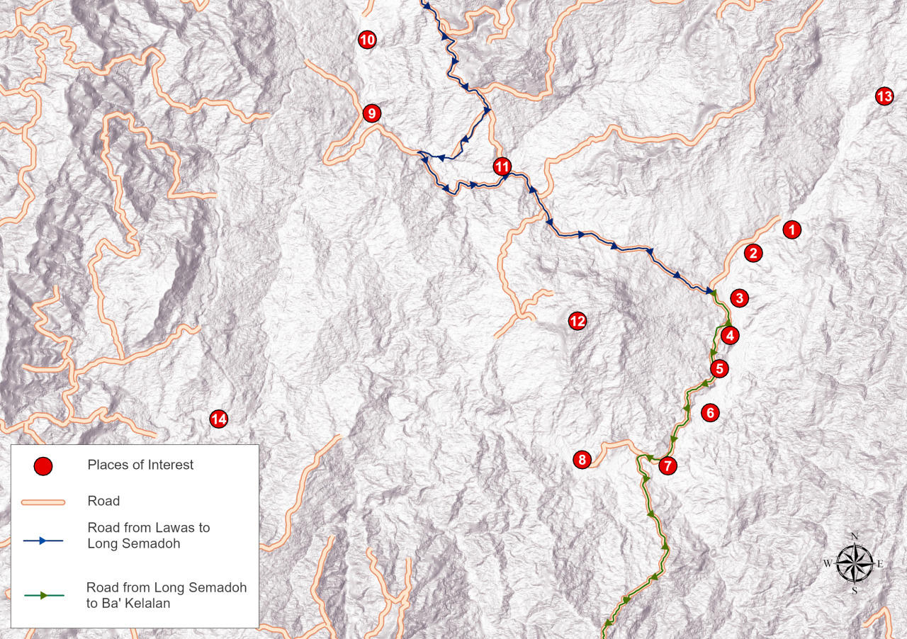
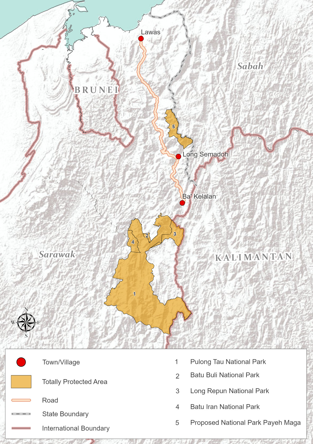
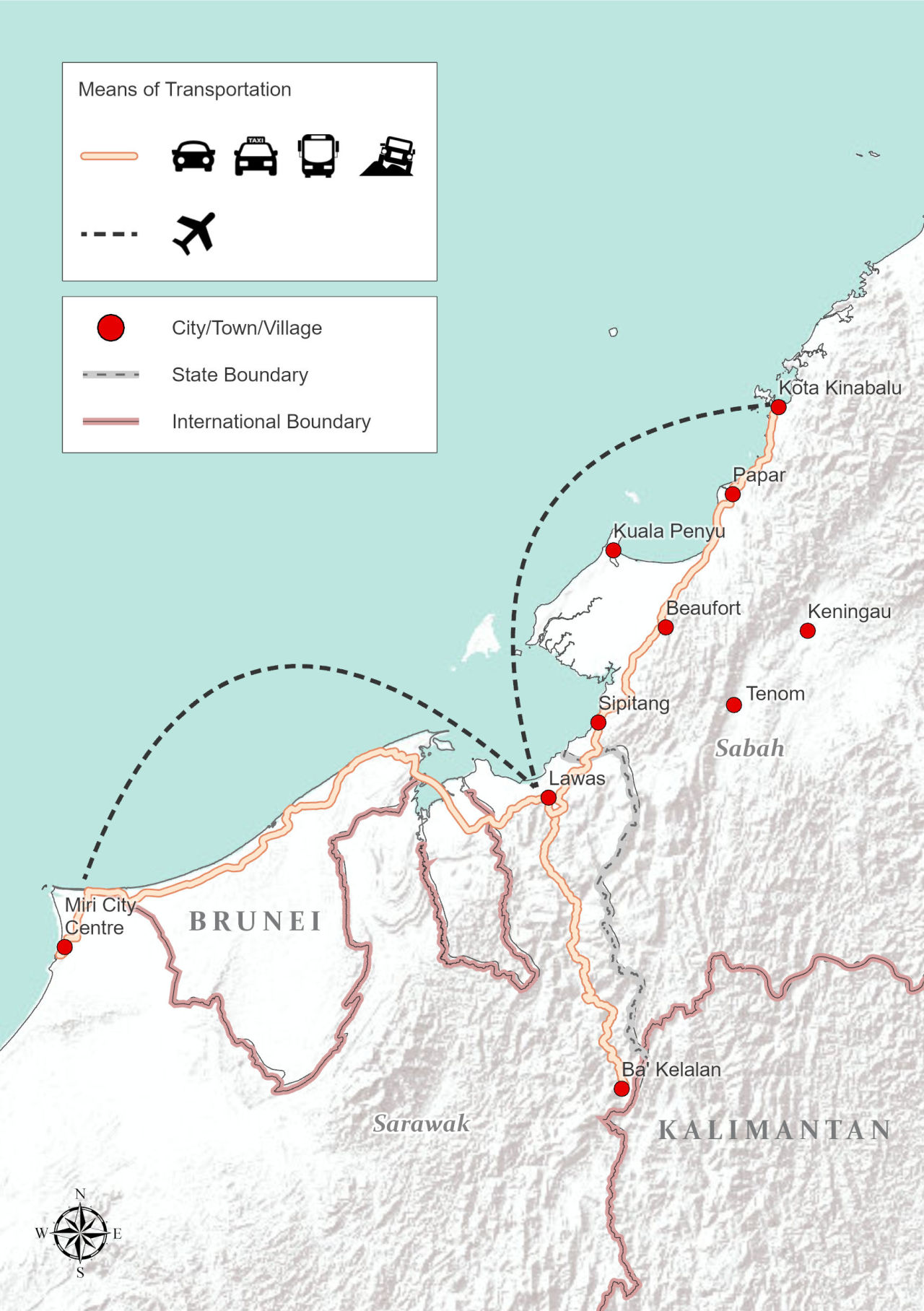
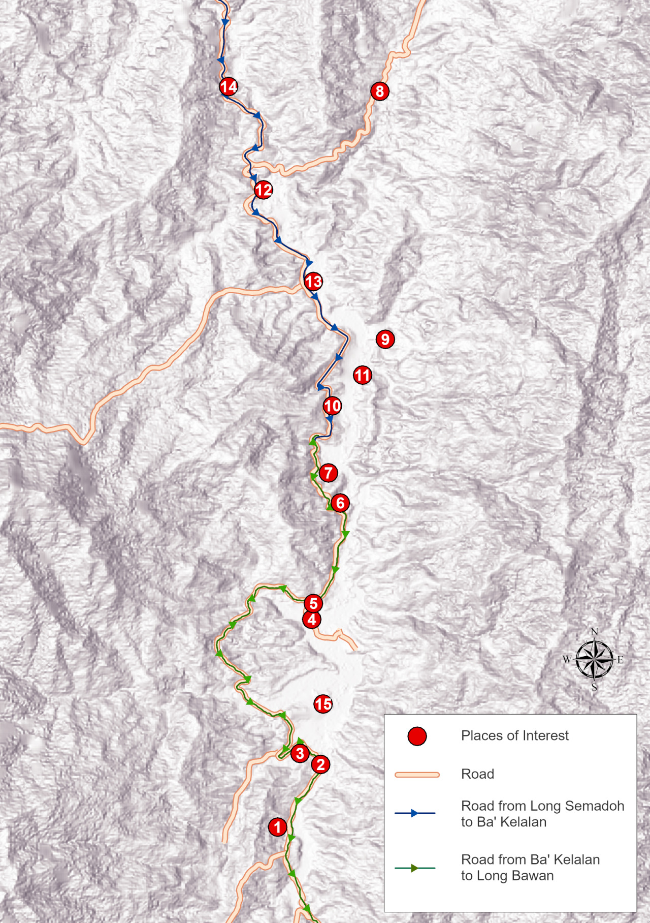
Miri is the gateway to the beautiful northern highlands of Sarawak is where the we have our very own highlanders, the Lundayeh/Lun Bawang, Sa’ban and Kelabit people. Some of the beautiful settlements up in the north that should not be missed are Ba’kelalan, Long Semadoh and the infamous Bario. The beautiful distribution of settlements and paddy fields woven into the forest thickets, the local communities are a rare marriage of modernity and deference to their cultural ways of livelihood, inherited from their predecessors. Beautiful homestays and even more glorious landscapes with trekking activities and learning the simple ways of highland living. And this is the culmination of ardent passion by my two absolutely wonderful colleagues, Alicia Ng and Cynthia Chin.
 |  |  |  |
|---|
 |  |
|---|
 |  |  |  |
|---|
Development of maps for publication
Most part of the maps were made using readily available basemap provided by Esri in their Living Atlas. But in entirety, many of the features and details are drawn manually within ArcGIS Pro. Like many other mapmakers out there, the labeling feature is horrendously temperamental and I either end up using annotations instead.
In summary, technically, there are 2 lessons learned here:
1️⃣ Establish concept or pick an idea before you start drawing
A concept of the map and palette should be established at the earliest stage possible. And don’t just throw the task of making maps and split them evenly between cartographers. They won’t have similar ideas or similar interpretations of the concept. It’ll only give you double the pain of creating the maps again from scratch.
2️⃣ Omit borders
If you’re making maps for books, don’t border trying to make borders and fully utilize the whole layout. In the end, you’ll need to export out your maps and they will resize it anyway and it’ll compromise the maps you created. As if it wasn’t graining enough in the first place, it’ll look absolutely microscopic by the time they’re done.
_______________________________________________________________________________________________
TOOLS
1️⃣ ArcGIS Pro 2.9.3
2️⃣ ArcGIS Online
3️⃣ Python
4️⃣ HTML