🗺️ IKI Landuse Plan - Green Initiative in the HoB Report | WWF-Malaysia
Several maps are developed to aid or supplement the Natural Capital Valuation (NatCap) initiative. As cited by WWF:
An essential element of the Natural Capital Project is developing tools that help decision makers protect biodiversity and ecosystem services.
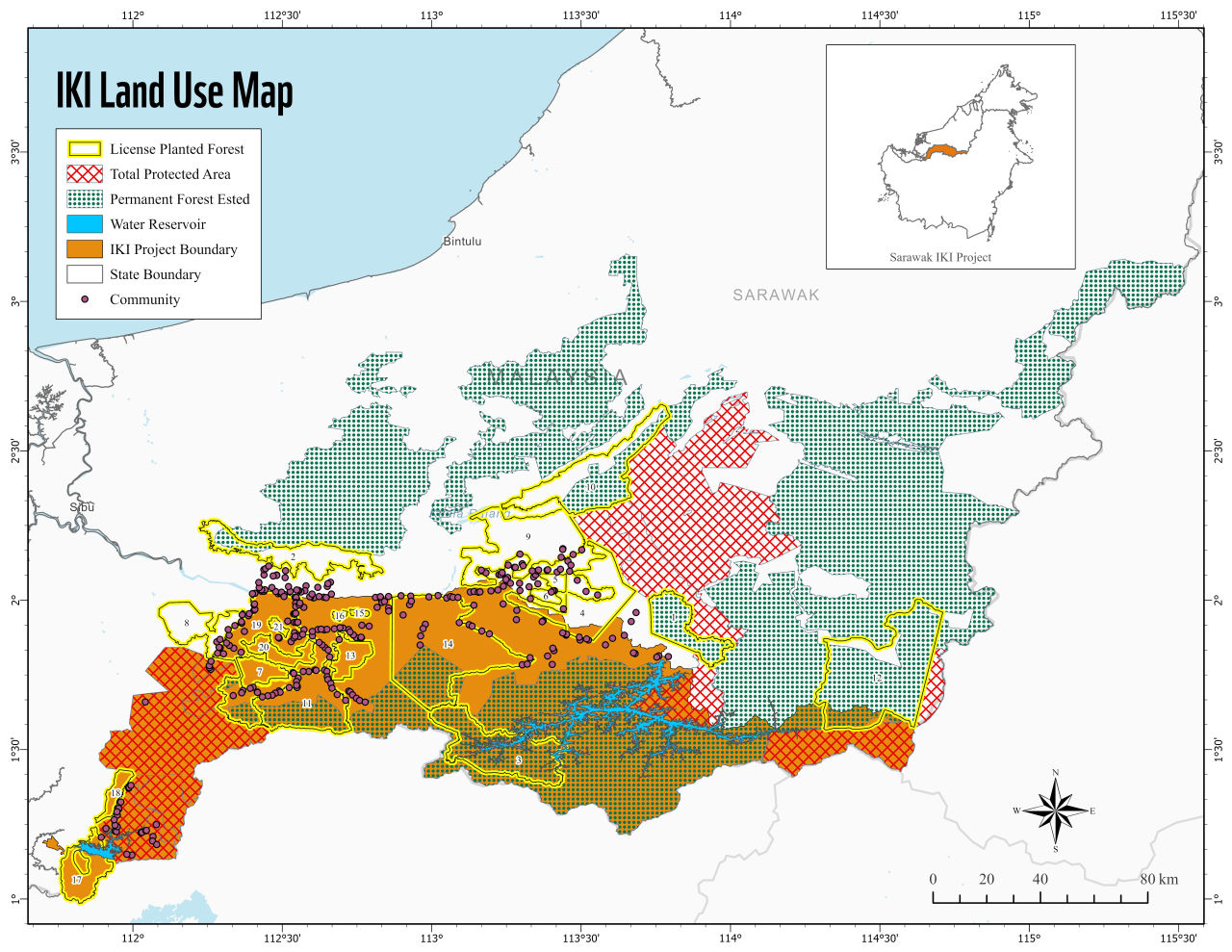
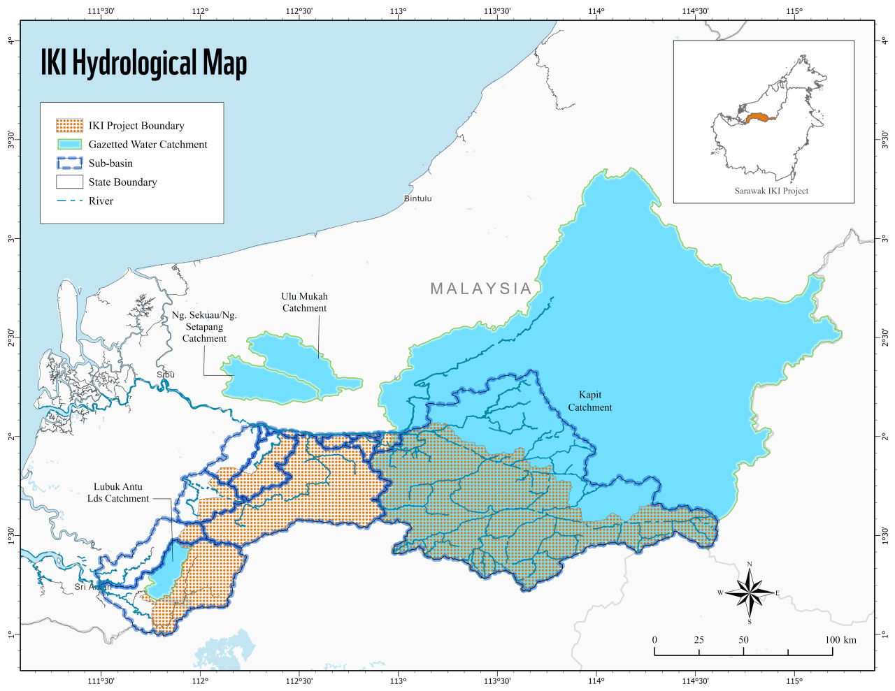
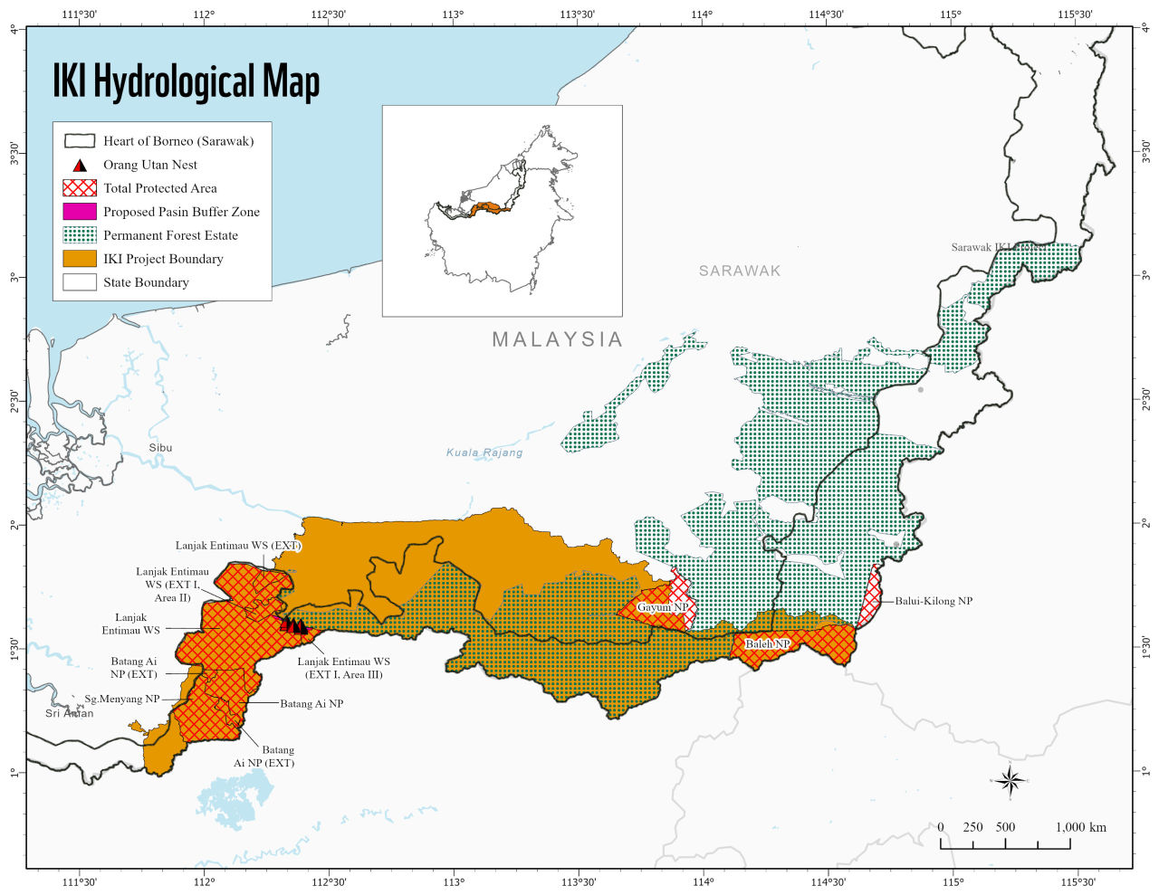
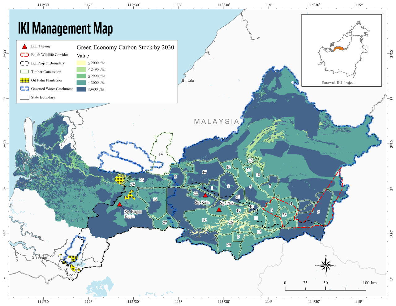
Within the Rajang Basin, the study of the capacity of the land use within the basin to sustain its natural biodiversity assets in few business models; business as usual, conservation and green economy. Information required in this model helps to map and value the goods and services form nature that supposedly sustains the livelihood of humans in the populated areas. Specifically for this exercise, the visualization of policy and land use eventually become the data input utilized in the tool InVest that generates the models and maps for the economic values of ecosystem services within the landscape of interest.
 |  |
|---|
 |  |
|---|
Collection of data layers for modeling
The generation of the data mainly includes superficial remote sensing to assess the status of the land use in the respective concessions using Sentinel-2 satellite image with specific band combination to identify tree cover, particularly mangrove forest.
TOOLS
1️⃣ ArcGIS Pro 2.6.1