🌏 CE Strategy Dashboard 2021 | WWF-Malaysia
The northern highland communities of Lun Bawang have been collaborating with WWF-Malaysia under the Sarawak Conservation Programme (SCP) to empower sustainable economies and managing their natural biodiversity through the Community Empowerment Strategy (formerly known as Community Engagement and Education Strategy).
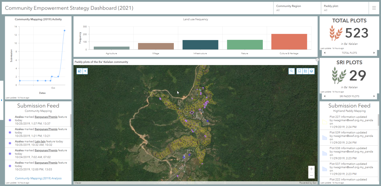
Since 2016, the communities have been actively mapping out their land uses and culturally important locations to delineate their areas of settlement and source of livelihood. Given the close vicinity of their communities to the licensed timber concessions, producing a definitive map is important to preserve and conserve their surrounding natural capitals.
Centralized end-to-end data pipeline for field data collection to desktop analysis
Several outreach has been done and the community mapping effort has been shifted to implement citizen science via the Survey123 for ArcGIS mobile application which is apart of the ArcGIS ecosystem. This enables the local community to collect information despite the lack of network reception and the data can still be synchronized upon availability automatically or manually shared with the field officers.
TOOLS
1️⃣ ArcGIS Pro 2.6.1
2️⃣ ArcGIS Online
3️⃣ Operations Dashboard for ArcGIS
4️⃣ Survey123 for ArcGIS
5️⃣ XLSForm
7️⃣ HTML
STATUS
🛑 Accessibility retracted 2021